 Last week I drove up to the northwestern corner of North Dakota for two reasons. I wanted to spend a few days hunting grouse with three good friends and I wanted to see the effects of America’s latest great oil boom. My only experience in that country between the Missouri River and the Canadian boarder was to zip through it in the dead of night on my way to Saskatchewan. In truth, I had avoided it for the last ten years because of the oil boom – like avoiding a visit to a hospitalized loved one.
I had been looking forward to the trip for most of a year. We were four busy guys who didn’t take enough time to spend together. We needed to unwind and we were headed for the perfect place to get that job done. It is the prairie pothole region of North America, famous for thousands of undrained ponds, ringed with native grass and laying placid under a sky made immense by the lack to trees. I am not a religious man but, when I thought of the trip to come, I could hear the poet in my ear, “…making me to lie down in green pastures, leading me beside the still water…”
Erney and I had been working the bird dogs in harnesses to get them into shape so they were ready to run hard for an hour or two at a crack, even in the warm weather of late September. But, as usual, I had left all other preparations to the last minute. On Sunday morning I found myself running around, looking for hunting clothes, cooler, water jugs, shotgun, shells, and a map of North Dakota. I can drive by memory to lots of places in North Dakota but, for me, the far northwestern corner is a terra incognita. My wild guess at driving time was six hours and it was already noon. I dug through the Rubbermaid trashcan in my office where all the maps are kept. I was sure that there were several maps of North Dakota in there somewhere, but I came up empty handed. Time was ticking away. Erney had already loaded the dogs, the dog food, the stake-out chain, and the combs for extracting burrs from the setters’ coats and was standing near the pickup tapping his foot.
When I yelled up stairs to ask Jill if she had seen a map of North Dakota, she yelled back that I was nuts. “Google it,” she said. She knew perfectly well that I had no idea how to produce one of those nifty little lists of routs, turns, and times that lead millions of people to their destinations everyday. She also knew that I had little faith in such sterile instructions. But there was a challenge in her voice that would not allow me to ask her to do it for me. I sat down at the computer and – tap, tap, tap – I had the directions to get to where I was supposed to meet my friends. I was incredibly proud of myself and waived the paper as I kissed Jill goodbye.
I drove to Bowman, North Dakota without consulting my Google map or list. Thirty-five years before I had worked in the northwest corner of South Dakota for the South Dakota Game and Fish Department and so all the country between our ranch and Bowman was as familiar as my backyard. In those days I was the state “raptor specialist” based in the most sparsely populated county in South Dakota. Back in the 1970s, being the “raptor specialist” only meant that I was one of the few people in the Game Department that could tell one chicken hawk from the others. My job was to keep an eye on the literally hundreds of raptor nests in that huge, bountiful, and lonely county. It used to be that you could drive all day and never see another vehicle. But last week I followed a line of heavily loaded, semi trailers moving north to the oil fields. By the time I got to Bowman and first referred to the Google printout I was in a traffic jam of diesel belching monsters.
I knew that the country that I was entering was laced with rivers with wonderful names like the Cannonball, the Little Missouri, the Heart, the Knife, and – of course – the Missouri herself. I wanted to see how my line of travel traversed those drainages. I wanted to linger over the Little Missouri where Teddy Roosevelt had his ranch. I wanted to see what twist in the big Missouri River could cause the bridge at New Town to run east and west instead of north and south. I was curious to know the size of the Fort Berthoud Reservation.
But none of that information appeared on the Google printout. It just said: Turn right onto US-12 E/US-85 N/Canam Hwy. But US 12 was closed for maintenance, no doubt made necessary by the pounding it was getting from the long line of semis in front of me. I didn’t know what else to do so I followed the trucks. We came to a river that I thought would be the Cannonball, but it was the Cedar. I looked at my Google printout for guidance. All it said was that my next turn should be onto N Dakota 200E. But because I had been rerouted, I didn’t see N Dakota 200 for nearly a hundred miles. Just off the asphalt, where the blue diesel haze thinned out, the country rolled and pitched in prairie and wheat fields. I missed the Cannonball and the Heart and Knife and still have no idea how that happened. There was no way for me to know where Theodore Roosevelt National Park was. All I knew was that if I ever came to N Dakota 200 I was supposed to turn right – then left on N Dakota 22 N.
The only time I knew where I was when the truck in front of me started across the bridge at New Town. The compass in my truck told me that I was indeed heading straight east, but without a map I had no idea what great contortions the earth and the Missouri River had executed to make that possible. I had never felt more lost. My expectations of a leisurely, informative drive through a part of the country that I was unfamiliar with, were exploded. It dawned on me that a Google printout is not intended to teach the user anything about the world. It isn’t meant to be used as an educational tool. It only refers to ephemeral, man-made phenomenon and ignores the world that interests me. Unlike a real map, a Google map is only useful to get people from one place to another place and only works when there are no surprises, no changes that might require a switch to plan-B. I stopped in a crowded and dirty convenience store for gas and a map. I waited in line behind burly oilmen speaking with Oklahoma accents. When I paid for the gas I asked the harried Indian girl behind the counter if they had any maps. She took my money and shrugged. “Had some,” she said, “but they bought them all.”
On the other side of New Town the road was again under construction and I fell in behind a ¾ ton pickup with a bumper sticker that read, DON’T RE-NIG IN 2012. It took a couple blocks for the meaning of the bumper sticker to sink in but, once it did, my frustration turned to a sort of road rage. I was stuck in stop-and-go traffic behind that damned truck for an hour. When the road split he pulled into the turning lane and I pulled to have a look at the kind of guy who would adorn his truck with something as offensive as his DON’T RE-NIG bumper sticker. He was a grizzled man about my age, in need of a shave and wearing a Halliburton hat. Our eyes locked for an instant as I passed.
The traffic plodded ahead until we came to a sign announcing North Dakota Route 8. I glanced down at my Google printout and there it was, Turn left onto N Dakota 8 E. I spun it hard to the left, out of most of the traffic and up highway 8 toward the town of Stanley where I had heard the pothole coteau began. This was the area that my friends had talked about. There were still big trucks entering and leaving the road, but they were thinning out. The dust was settling and the sun shone through it like evening on the Serengeti.
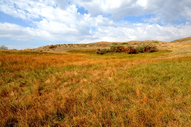
Suddenly I was within striking distance of my destination. I looked to the printout and saw that I was just three turns away from my destination. The sun angled across the road, the air was still, and finally I saw the grasslands I had come to see. They rolled around a hundred ponds that pocked the countryside for miles. Ducks purred in every one and I imagined that the grouse would soon be flying from their feeding ground to bluestem ridges.
I was in Stanley two hours behind schedule but, for the first time all day, I had some idea where I was. It was quiet compared to New Town and I pulled into a gas station and bought a map. I unfolded it on the hood of my pickup and traced my path from the South Dakota line to Stanley. There they were: the Cannonball, the Heart, the Knife, the Little Missouri. I tried to think back to where I had crossed them – tried to recall how the land undulated to accommodate their channels. I put my finger on White Butte, the highest spot in North Dakota, traced the outline of Teddy Roosevelt Park and the course of the Missouri up to Montana. With my index finger I memorized the last thirty-five miles to where my friends waited.
Seeing it all like that comforted me and I exhaled as I folded the map and turned to get back into my pickup. I was smiling and beginning to feel the calm that I longed to glean from that trip. But, as I slid into my pickup, another pickup pulled in beside me. It was the grizzly man with the offensive bumper sticker but I was not going to let him ruin my mood. I continued to smile and raised my hand in the single finger salute. His chin jutted out and he glared at me. I continued to smile and held his eyes as I put the pickup in gear. As I pulled away, I wadded up the Google printout and tossed it into the bed of his pickup.
Comments 17
Hi Dan,
Me again. Your English major, photographer friend who came twice to shoot bison at your ranch, thanks.
Second paragraph: “laying placid,” should be “lying placid.”
Lay: to put. Principal parts of the verb: Lay, laid, had laid. The verb means action is done on something, such as to lay the book on the table, yesterday I laid the book on the table, after I had laid the book on the table…, etc.
Lie: to recline. Lie, lay, had lain.This verb means the subject is itself doing something. The prairie pothole region lies in the northwestern part of the Midwest, I am lying in my bed, as I lay down to sleep, after I had lain in bed for an hour… etc.
Enjoyed your adventure. I’m not a Mapquest fan either, but it does work a bit better in the city. Thanks for preserving our English language heritage.
Linda, Minneapolis
Great article! Love the end!
Hi Dan,
I enjoyed your adventure and the descriptions of your road trip! Since I grew up on a wheat farm in Divide County (near Crosby) I thought you might go that far to the NW of ND. I could identify with the towns you mentioned. Divide Co is the 2nd fastest growing county in ND because of the oil boom. This is sad, but true.
Thanks again for an interesting read!
Great Article Dan, but even good ol” buffboys ” have to get techy! Tell Jill you want an Iphon and/or Ipad for Xmas! Siri(the feature you talk to your phone and tell it what you want it to do for you and it does, tho doesnt always…) can get you anywhere or the Maps app feature…make sure you go with a good provider that has access everywhere….we use ATT(not best in USA) but we can get cell most of the planet when traveling.
Dan – great story! I love paper maps – real maps, like the one you purchased and spread out on your truck. I could feel your frustration winding through the story….until you bought the map. Who would think that a paper map could bring such comfort? I would.
Trying to keep the traditional art of map-reading alive, I used to give my kids maps in the backseat on our family trips and taught them how to read and enjoy them. They never had to ask “are we there yet?”, they were too busy trying to figure out what the next town, river or mountain range was lying ahead!
Recently, I gave my 10 year old grandson the same opportunity and he soaked it right up! Hopefully, he too will become what I like to call myself, especially when I am unable to travel as far and wide as I would like….”road-map vagabond”.
Please let us know how you enjoyed the rest of your trip!
“Halliburton Hat” …..LOL!!!!
Dan,
Very funny!
Hi Dan,
I’m just a city girl who yearns to someday travel and see these wide open spaces for myself and show my children and grandchildren. It does my heart good to hear how you are creating jobs, an enriched economy and a way of life that preserves the land and provides a way to protect and nurture the buffalo ( and I’m sure a lot of other native species). The efforts of you, your wife and the rest of your crew are most appreciated even from suburbia.
I think this article would make a great op-ed piece (in some midwestern papers?) or a email to be blasted to the environmental groups – altho that’s like preaching to the choir. Time to let the people know how much the oil/gas enterprises affect the folks who have to live with it and how it trashes the last clean, unpolluted areas of the country. Thanks again.
Dan: I completly agree with you about Google and related electronic devices and thus I have never used them and have refused to allow others traveling with me to do so despite their insistence to do so, As a consequence I mostly go alone-which is ok with me! Exploring “wilderness” areas by roads or otherwise without using paper maps is dangerous for many of the reasons you cited and clearly does not lend itself to an experience with the wonderful country you live in. Frankly I do not understand Jill,s reaction and advice to use Google. Cheers! Jim
Loved your article. I, too, would of wanted to know why a bridge went from north to south on an east to west road. Or something like that. And would want to take a longer look at Roosevelt’s ranch. And, for sure, no google maps for me. Love the paper map spread out on the hood of the car; half the fun is the challenge of re-folding it!!! Where is the peace, the calming effect on our spirit. Look for it; it’s right there in the Hills, on the Prairie, along the river banks; and most of all in the fall, crisp air.
And now, google map, take your place there in the waste paper basket.
That says so much in so few words.
Thanks for your writings.
Great story, Dan. Signed, a fellow printed map lover.
Good story Dan. I think Linda should go lay by her dish.
Hi Dan, Enjoyed this, as I do most of what you write. I have a question on another matter, though, and don’t know of another way to reach you. I’ve been contacted by the McGillicuddy House folks to do some work for them and I want to learn what I can about Valentine. I have your book, but wonder if you have other resources/suggestions for me. I trust your judgement on what is good and useful. Thank you!
I too love REAL maps. So much so, that I hang them up at work so others can learn from them. I agree, that so much knowledge of the surrounding area is lost in the google maps. However, Google earth aerial photos are awesome and offer a wealth of information to the observer.
I would not complain too much about the oil boom.
I live in the midwest and we have been hit hard by this horrible ecomony and the high cost of energy. I believe that if the costs of food and energy were included with the inflation calculations. Inflation would be in the double digits. That oil is giving the rest of the country direction on how we can get out of this recession. Energy independence. Yipee!
You are the right fellow to show the energy companies how to respectfully extract the resource from the land with minimal damage and make money doing it.
Maps are such a wonderful way to learn about our planet. One dry year, while traveling from northwestern NE to Lincoln in the southeastern part of the state, I was amazed to cross a bone dry Platte River in central Nebraska, only to cross a very plentiful Platte River further east. Consulting my map, I “discovered” that east of the dry stretch in the Platte, a network of streams originating in the Nebraska sandhills replenished the rivers’ flow. Those sandhills, which lie over the magnificient Ogallala aquifer (which, I presume, gives rise to the streams emptying into the Platte), are where the Keystone XL pipeline would run, transporting (and leaking) oil from North Dakota and Alberta. Small world — getting smaller all the time.
Another stunner, Dan. I never get lie/lay and their tenses right either. Are you still flying a jerkin? If so, let me know his weight. Did you hook up with Ralph and Wilde?
Stumbled upon your website and was enjoying reading your Mission and thinking how refreshing it is to find such a socially responsible company. Thought: I have to bookmark this to be sure to come back sometime, and possibly order. Then I read this article AND I WILL DEFINITELY COME BACK AND ORDER! Your response to the bumper sticker sold me on what wonderful, caring, concerned folks you must be and I want to support you and your business. I will spread the word too! Like that old commercial -I’ll tell 2 people, and they’ll tell 2 people, and they’ll tell 2 people….exponentially. Hope it brings you lots of advertisement and business! THANK YOU AND BEST REGARDS!